
'X' marks the spot with Abigail Collins
6/2/2014
My post content34.1383° N, 116.0725° W / Lt. Sims, 2014 from abigail collins on Vimeo.
In this video installation, Abigail Collins juxtaposes drone footage of a barren landscape with a conversation about how the LAPD documents an incident. Just as a mysterious X-shaped structure sits in the middle of an open field, the Lieutenant describes how law enforcement often produces various sketches in which “‘X’ marks the spot”.
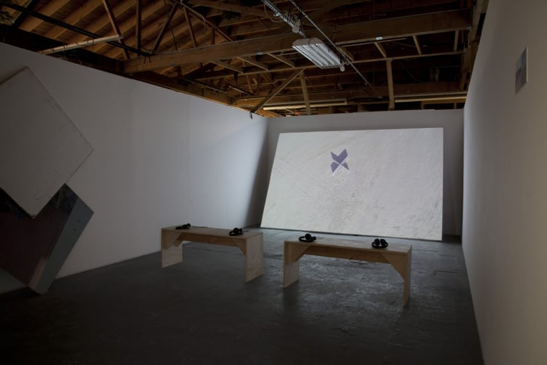
Without any context besides the coordinates in 29 Palms, CA, the piece resembles a document leaked by some covert operative on Wikileaks. To stumble upon this discovery is like unearthing an illicit document beneath some virtual abandoned battlefield.
Abigail Collins gives GRAPHITE a full disclosure on how she formed interest in the subject matter, and how the piece came together:
“With both the video and the audio, I was (and still am!) thinking through ways that aerial views are used to flatten landscapes, visually and ideologically. I shot this footage with a small drone near the 29 Palms Marine Corps Air Ground Combat Center, where they test drones and other aircraft. The view from the drone only captures the top of the X installation, supplanting the vision of those on the ground.
I also interviewed an LAPD Lieutenant who describes the most precise way to document a crime scene: with a computer program that sketches the scene from above. The drone’s claim to an objective perspective negates the point of view of those on the ground, so the interview was a way to investigate how that same aerial flattening works ideologically when the perspectives of the individuals are claimed to be less important than the measured distances between them.”
Stay tuned for more contributor profiles and interviews. GRAPHITE Issue 5: Networks will be released on June 6.